Trusted by sailors since 1978 – available in print & eBook
Svalbard Why, How, Where and When
Svalbard is an archipelago in the Arctic consisting mainly of the islands of Spitsbergen and Nordaustlandet, along with many smaller islands between approximately 77° and 80° N. Bjørnøya (Bear Island), located at 74°27′ N, 19°04′ E about halfway between mainland Norway and Spitsbergen, is also part of Svalbard.
Why
A voyage to Svalbard is a unique high-Arctic experience. Few other places allow yachts to reach such high latitudes — only about 600 nautical miles from the North Pole — without extreme ice conditions or exceptional difficulty. In most summers, access is possible in generally moderate conditions.
The archipelago is also rich in wildlife and holds a remarkable cultural and historical record, ranging from early whaling activities in the 15th century to sites dating from the Second World War.
Bjørnøya
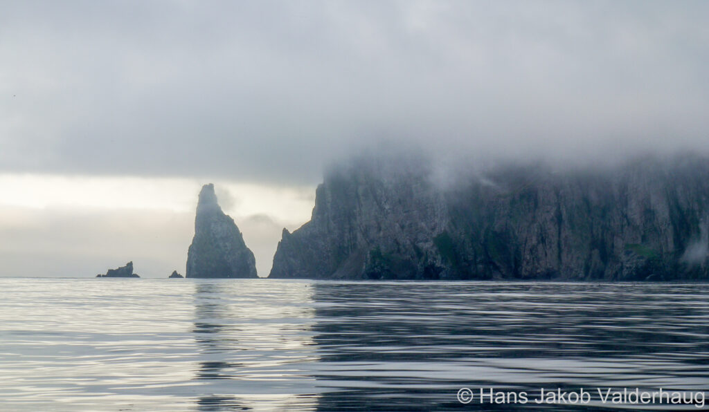
Bjørnøya, though bleak and exposed, has a stark and striking beauty. The coastline is alive with seabirds, and the high black cliffs and eroded rock stacks create an austere and dramatic landscape.
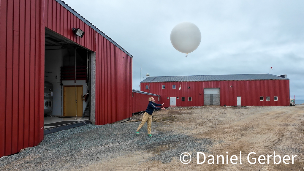
The island has no permanent residents, except for the small team stationed at the Bjørnøya Meteorologiske Stasjon in the north.
Spitsbergen and Nordaustlandet
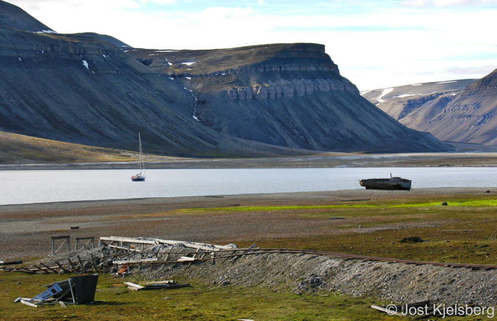
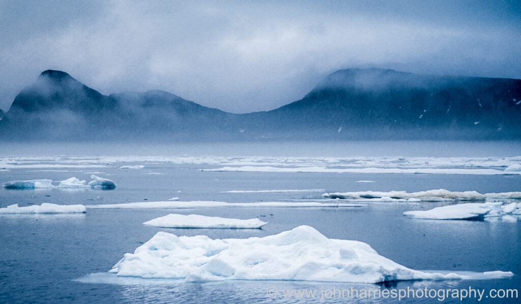
The coasts of Spitsbergen and Nordaustlandet are deeply indented by fjords, which offer good anchorages. Blue glacier ice is often present, drifting quietly through the water. The scenery includes vast ice caps broken by sharp mountain peaks, and many fjords end at glacier fronts several kilometres wide, with ice cliffs rising many mast heights above the sea.
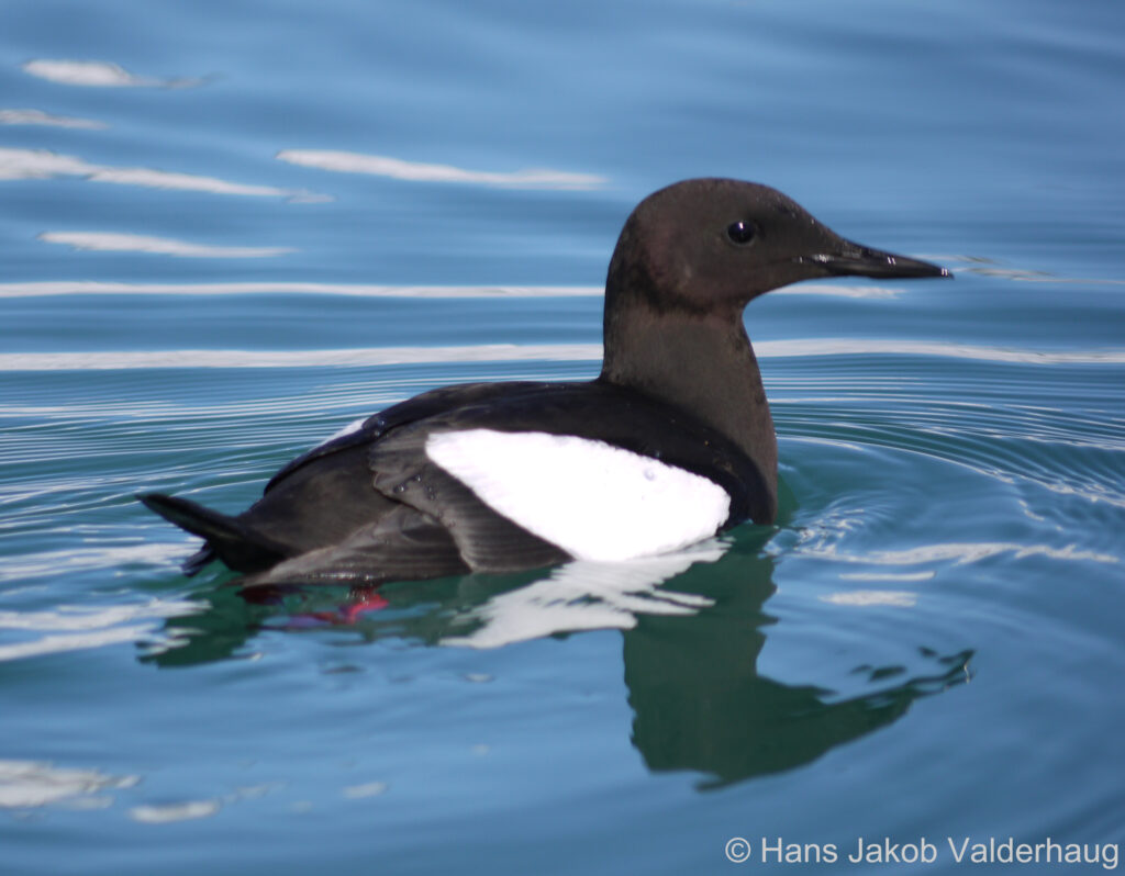
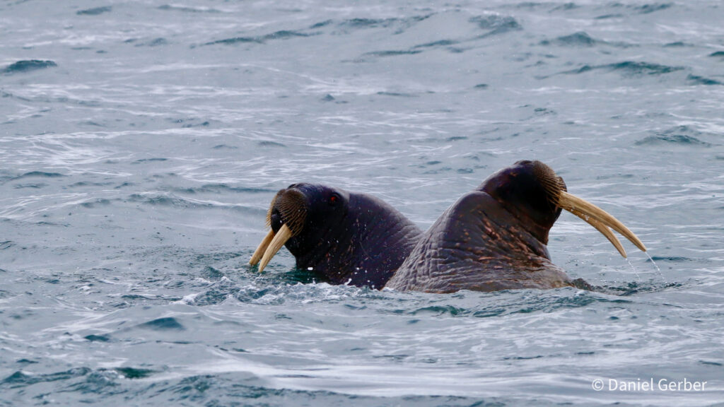
Wildlife is abundant. Birdlife is particularly rich and includes the Arctic tern, which makes the longest migration of any bird, travelling between Arctic and Antarctic summers. Mammals include polar bears, Arctic foxes, seals, walruses, reindeer, and several species of whale.
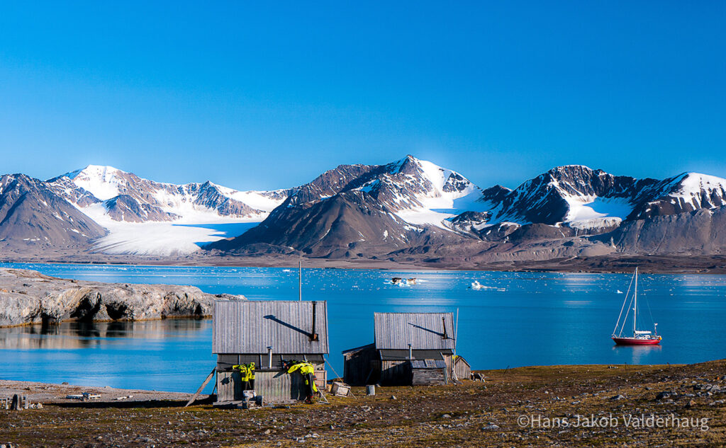
Svalbard has around 3 000 residents, mainly Norwegian, Russian, Ukrainian, and Asian, representing more than 40 nationalities. Most live in Longyearbyen and Barentsburg. Ny-Ålesund has between 40 and 150 inhabitants, the Polish Research Station in Hornsund around eight, and the Norwegian meteorological station on Bjørnøya is staffed year-round by nine people. A small number of cabins are scattered across the islands and are used by trappers and officers of the Governor.
Tourists arriving by cruise ship or aircraft are concentrated in a few locations. While you may occasionally share a fjord with a cruise ship, much of the time you will find yourself completely alone.
How
The most common departure point for Svalbard is Tromsø, where final provisioning, fuelling, customs, and border formalities can be completed. Offshore departure is usually via Kvalsundet, Torsvåg, or through Fugløyfjorden.
From Torsvåg, the distance to Hornsund is about 450 nautical miles. Sailing further east or northeast before heading offshore does not significantly reduce the ocean passage but can improve the wind angle, depending on conditions. With a modest increase in distance, it is also possible to sail directly from Lofoten or Vesterålen.
Bjørnøya lies conveniently roughly in the middle between mainland Norway and Spitsbergen, dividing the passage into two legs of about two days each. It has no all-weather harbours, but anchorages exist on all sides of the island, and shelter can usually be found.
Ocean Currents
Currents on the passage to Svalbard rarely exceed 1 knot but they are complex:
- North of Torsvåg, the current generally sets NE with local eddies.
- South of Bjørnøya, it also tends to set NE.
- W and NW of Bjørnøya, the current flows N along the W coast of Spitsbergen. This branch of the North Atlantic Current is largely responsible for Svalbard’s relatively mild climate for its latitude.
- The waters around Bjørnøya are often affected by tidal eddies and can become rough and dangerous in strong winds.
- Along the SE coast of Spitsbergen, a S-setting current sweeps W around Sørkapp and joins the N-setting current on the W coast. Early in the season, this current is a major contributor to pack ice on the SW coast of Spitsbergen, sometimes also carrying polar bears with it.
Where
Most yachts confine their cruising to the relatively sheltered and more frequently visited west and northwest coasts of Spitsbergen, often with a short trip north to Moffen at 80° N. Improved charts and reduced pack ice are now encouraging more boats to venture further east.
The north coast of Spitsbergen and all areas to the east are virtually uninhabited and far more isolated. Ice conditions are more hazardous, with a real risk of being trapped between land and pack ice. Chart surveys are also less complete. These areas should be attempted only by well-prepared crews with experience of high-latitude sailing.
When
Bjørnøya and the west coast of Spitsbergen are generally free of extensive pack ice from June to November. That said, depending on the wind, the fjords can carry a considerable amount of berg ice from calving glaciers throughout the summer. From mid-August onwards, the likelihood of severe weather increases. Leaving too late in the season may result in a difficult and uncomfortable passage south.