Trusted by sailors since 1978 – available in print & eBook
Norway Navigation
Norwegian Government Charts (Kartverket)
Online
Kartverket charts are available online from norgeskart.no. At the time of writing the Norgeskart app only gives access to their raster charts, while navigating from the webpage also gives access to vector/electronic charts.
Kartverket provides their charts integrated with pilot information Den Norske Los online.
Kystverket (The Norwegian Coastal Administration) run the site Kystinfo.no. We have found that information about new cables and the like are updated earlier on this site than on official charts from Norgeskart. The site is available in English but is not as easy to navigate as the above sources.
Electronic Charts
There are a number of companies offering electronic charts for Norway. All base their charts on official data from Kartverket, although at least one supplier claims to also include user-generated data.
Paper
Paper charts are available from Kartverket as print-on-demand (POD), although some bookstores may still carry some local charts.
Catalogue of Norwegian Nautical Charts and Nautical Publications (in English)
Kartverket’s Official Nautical Charts
Norwegian and international retailers of the Norwegian Mapping Authority’s / Kartverket’s topographic maps and nautical charts.
NV Verlag Atlas
In booklets of charts from the Swedish border to Haugesund. 1:40 000 and harbour charts 1:5 000 – 1:25 000.
Introduction in English and Norwegian, including tidal data and an App.
Båtsportkart
In groups of chartlets from the Swedish border to Rørvik. In 2026 these are no longer in print, and the company Navigasjonsbutikken Kart AS are selling out remaining stock. They are in dialogue with Nordic about copyright and may in future publish updated editions, at earliest in 2027.
Sailing Directions

Den Norske Los (The Norwegian Sailing Directions) is no longer available in print, but some of the information is being integrated into the online edition of Den Norske Los.
The volumes are available as PDF downloads; however, they have not been updated since 2018. The text is in Norwegian only, with the exception of Volume 7 (Svalbard and Jan Mayen), but there are numerous sketch maps and aerial photos in the PDFs that may still be helpful.
Other Cruising Guides
Havneguiden
Though the text is in Norwegian, the aerial photographs and charts may be useful for pilotage. They have an app through which you can purchase the online equivalent to their printed books.
Velihavn
Compiled and updated by Redningsselskapet (The Norwegian Society for Sea Rescue), this website covers harbours along the mainland Norwegian coast. This site is in Norwegian only.
Norskehavneguide/Harbourmaps
An online crowd-sourced map-based guide, in Swedish, Danish, Norwegian and English.
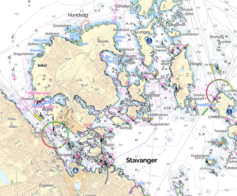
Aids to Navigation
There are thousands of Aids to Navigation (AtoN) along the coast of Norway; some are single isolated beacons and some are clustered thickly. The skill of their placement makes navigation of even the narrowest and most complex channels relatively easy.
For more on navigation symbols, see Symbols and Abbreviations on Maritime Charts (in English and Norwegian)
Many channels, such as Blindleia in south Norway (Volume 1) and the approaches to Veiholmen on Smøla, are positively alarming when first looked at on the chart due to the intricacy of navigation required, but you will find them perfectly easy to follow in practice, since every point of difficulty has an aid to point the way.
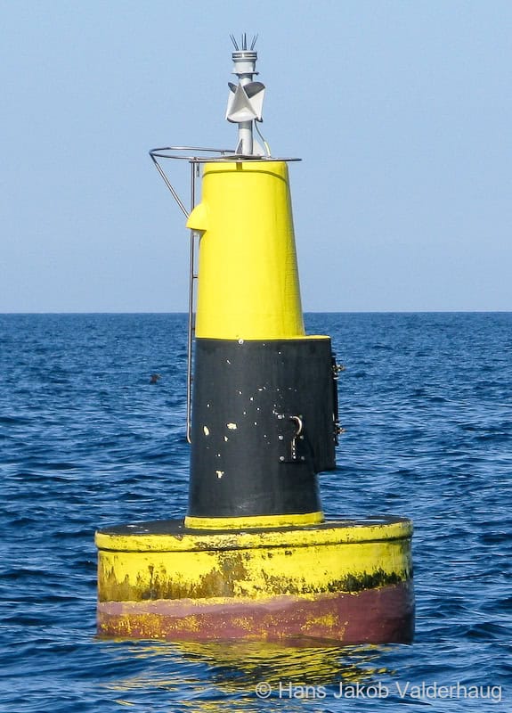
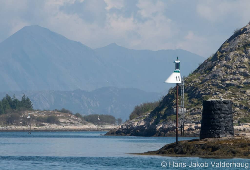
Buoys
Norway complies with the IALA A buoyage system, as used in the rest of Europe. When following the direction of buoyage inbound to a harbour, green buoys will be to starboard and red buoys will be to port. Likewise for sector lights. When following white sector into a harbour you will have a green sector to starboard and a red sector to port. Be aware that for some harbours buoyage marks the main passage along the coast, and not passage into the harbour which is your current focus.
The direction of buoyage originates at Norway’s southmost point, Lindesnes, and proceeds in two paths:
- One path follows the coast to the west, then north, then east around Nordkapp and then south to the Russian border.
- The other path follows the coast to the east and then northeast, then splits north towards Oslo and south towards the Swedish border.
In interior leads and fjords, the direction of buoyage is inwards from the sea, independent of the compass direction. Around islands there may be confusion regarding the direction of buoyage and you will need to consult the chart for clarification.
Black and yellow Cardinal Marks are commonly used, but often without the double triangle top marks or light signatures.
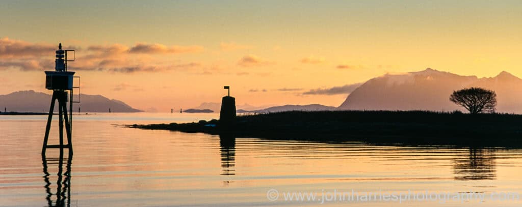
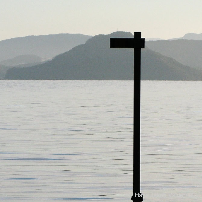
Varder (singular varde)
Varder are stone towers painted black, often with some form of white stripe, which makes them individually recognizable.
They make up the world’s oldest system of navigational aids still in use and are denoted on Norwegian charts with a 4-pointed star and a V. They may or may not be lighted.
Varder often carry top marks consisting of a short post supporting a single horizontal arm, in which case the varde should be passed on the side towards which the arm is pointing; however, do not blindly follow the pointer without identifying the varde on the chart and checking the depths shown.
Other varder may be passed on either side and these are used as landmarks, progress marks or leading marks.
Båker (singular båke)
A common type of beacon, båker are of no unique shape but most often are a tripod or latticework structure shaped much like a varde. They are denoted on Norwegian charts with the same 4-pointed star as varder but they are marked with a B rather than a V.
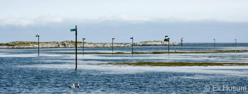
Perches
A jernstake (steel pipe), usually embedded in a rock are used in the same way as varder and båker but at a more local level. Numerous perches may be used to mark a channel through a group of rocks or an offshore shoal may be marked on more than one side by perches with outward-facing top marks. Again, it is important to clearly identify the perch on the chart and determine which side to pass on; don’t just blindly follow a pointer.
Perches are clearly marked on Norwegian charts but are often visible only at relatively short range, and sometimes they only project a short distance above the surface at high water, so it is necessary to keep a sharp lookout. It would be a pity to hit a perch marking a rock over which you could have passed safely! Perches may have red or green reflecting strips.
Sector Lights
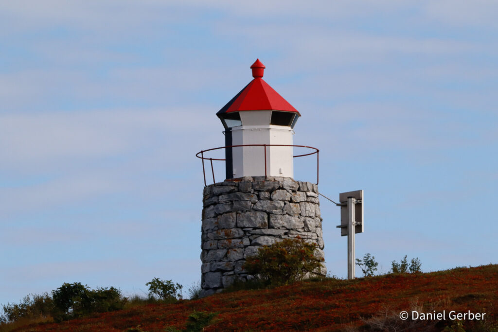
These are strategically placed in the skjærgård or in major fairways, enabling very accurate navigation in these intricate waters during the winter dark, in daylight the distinctive little cylindrical white houses with red roofs remain useful reference points for pilotage.
Lighthouses
All lighthouses in Norway are automated.
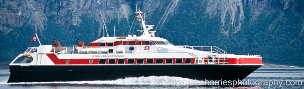
HIBs (hurtigbåt indirekte belysning / high-speed indirect light)
Express boats move at speeds of 30 knots or more where navigating using ordinary sector lights becomes difficult. With this in mind, the Coastal Authority has developed a new type of navigation mark, using solar panels, lithium batteries and LED technology to power a fixed white light that illuminates a fibreglass structure with red/green colour. The markers are usually numbered.
Regulations
The Norwegian Regulations for Prevention Collisions at Sea (COLREGS) largely mirror the International COLREGS, with one exception. Ch II of the Norwegian COLREGS titled “Special rules for Norwegian inshore waters” state that pleasure boats are required to keep clear of larger ships, ferries en route, and other commercial vessels when in narrow routes, in crowded or busy channels, and in harbour areas.
Awareness of this situation may help foreign pleasure boat skippers avoid unpleasantly close encounters.
It is worthwhile remembering the old Swedish saying that “Those who sail for their leisure should yield to those who sail for their bread and butter… “
Challenges
Coastal Danger Areas
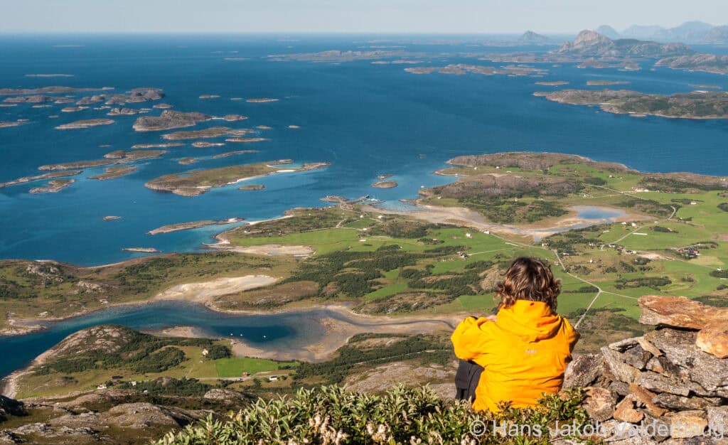
There are sheltered inshore passages behind the skjærgård (off-lying islands) for most of the coast between the Swedish border and Lindesnes (Volume 1) and then again for the long distance from Tananger to Nordkapp (Volumes 1, 2 and 3); so even when it’s quite windy you can sail in smooth sheltered waters most of the time.
However, there are places where there are gaps in these protecting islands and, when these gaps coincide with a Coastal Danger Area, you will need to take special care. Den Norske Los, Volume 1, lists 24 areas of the coast likely to have exceptionally high, steep or chaotic seas under certain conditions of wind and tidal stream. In these places bottom contours (even when at substantial depth), coastal topography, and currents interact to produce sea-state conditions that can be much more severe than would normally be expected for a given wind speed.
Coastal Danger Areas are shown on the map at the beginning of each Harbours and Anchorages chapter in the Guide.
We have constructed a free downloadable .kml file for importing into Google Earth that displays the Coastal Danger Areas with comments.
Tides, Tidal Streams and Currents
Details about tides, streams and currents are given at the beginning of each Harbours and Anchorages chapter in the Guide.
You will also find more information about this on the following web pages:
In Norwegian, a tidal stream is shown by –straumen or –strømmen at the end of a name (e.g. Saltstraumen and Brevikstrømmen), and –renna refers to a narrow passage (e.g. Risøyrenna), which may or may not have a strong tidal stream.
Tides
Kartverket provides online tide information
There is a progressively greater rise and fall of the tide as you travel north, with a spring range of around:
- 0.6 m at Stavanger
- 1.2 m at Bergen
- as much as 3.7 m at the Russian border
High water in Bergen is approximately 1 hour before high water in Dover.
Tidal Streams
Kystverket, the Norwegian Coastal Administration has developed a wave and current forecast for fairways
There are no significant tidal streams east of Lindesnes though strong currents may be found at the mouth of large rivers such as Skienselva and Drammenselva (5 knots is not uncommon).
West of Lindesnes there is considerable tidal stream in some of the inshore channels and in some of the fjords, due to river flow, wind and other factors, requiring transit planning.
Ocean Currents
On the southeast Norwegian coast there is a generally southwest-going current with maximum strength at about 3 –10 nm offshore. Strong winds may have an effect on the current, even to the point of reversing the direction. The current may also be reversed inside the islands in places.
West of Lindesnes the current sweeps round the coast and up to the north, though strong winds may have an effect, even to the point of reversing the direction.
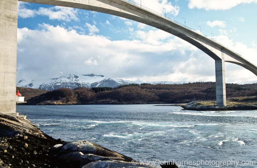
Overhead Cables And Bridges
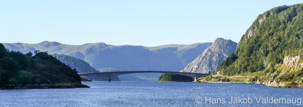
Overhead power cables are common in Norway. They are marked on the charts by a red broken line, with the minimum clearance at Highest Astronomic Tide (HAT) in metres shown in red. These markings are usually conspicuous, but they can be missed where they are printed over numerous islands or other features. New infrastructure is continuously being added. There is usually a sign posted on the shore near the cable showing clearance in metres. The clearance shown on the sign and that printed on the chart may not always agree which leaves it to the skipper to make a judgment call.
The clearance of bridges is shown in metres at Highest Astronomical Tide (HAT). It is shown on charts e.g. as Bru(15). New cables and bridges are being built all the time due to Norway’s commitment to providing infrastructure to outlying areas.
For up-to-date information consult Kartverket’s online charts. At the time of writing only their raster charts can be viewed on the app, for vector / electronic charts you need to navigate the website. This information is also available at Kystinfo.no.
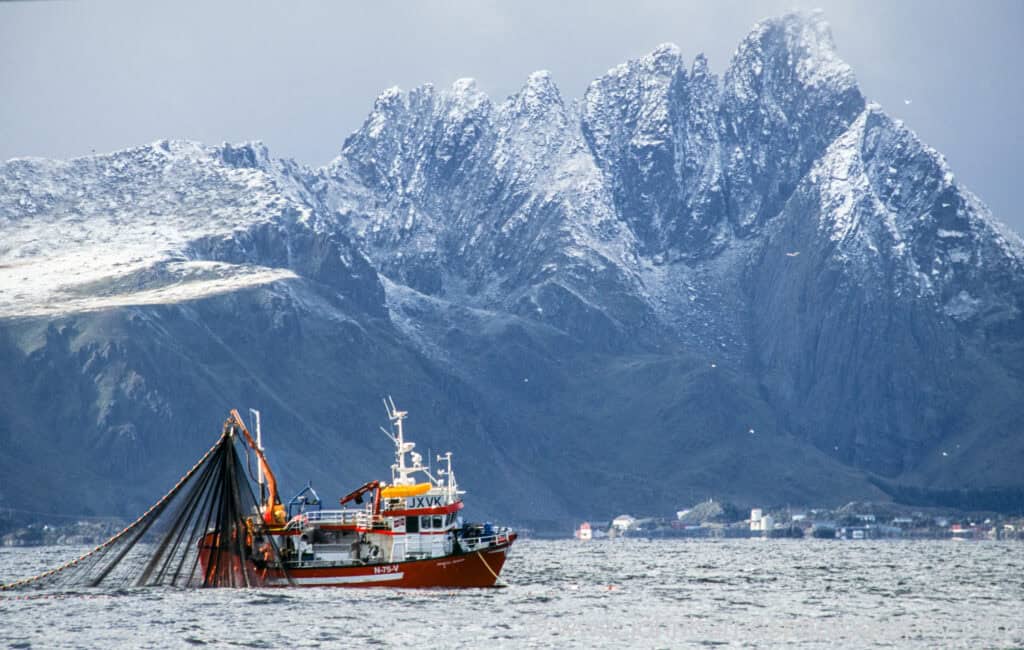
Fish Farms And Fishing Gear
Not all the many fish farms in Norway are shown on the charts, as their positions often change, so it is important to keep an eye out for them. Another thing to be aware of is that mooring ropes have been known to run between the yellow surface buoys and the shore with little to alert the mariner to their presence.
Every year, October 1 marks the start of the lobster season in Norway. It lasts until November 30 south of Stadlandet and until December 31 north of Stadlandet.
Along the coast of Northern Norway and in the Finnmark, the invasive king crab is being harvested all year round. Fishing is conducted using pots (traps) in coastal waters and fjords, typically from shallow areas down to several hundred metres in depth.
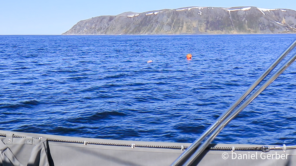
The buoys marking the traps are small, usually without flags, and difficult to see even in daylight in a flat calm.
The BarentsWatch FiskInfo online portal provides public real time information about fishing gear deployed in Norwegian waters. The site is mainly targeting commercial fishing.
Restricted Military Areas
There are a few small military areas still indicated on raster charts, such as Ramsundet on the passage north from Narvik. Over the last years passage through (but not stopping) has been allowed. In the current safety situation it would be prudent to enquire with the Coastal Surveillance Centre before approaching such an area (Tel: +47 75 53 62 95 / +47 75 53 62 96, E-mail: csc@coss.mil.no), or enquire with the Coastal Radio who will usually be updated about any restrictions.
Magnetic Variation And Compass Dip
The magnetic variation is small enough on the northwest Norwegian coast to be ignored for most coastal navigation; however, on the southwest Norwegian coast the variation reaches around 5°W and, as you sail east from Nordkapp towards the Russian border, it increases to around 12°E.
Above 60°N a handheld compass might suffer from dipping, making it sluggish, but it should still be usable. Modern electronic compasses generally work good except in the High Arctic in Svalbard, where GPS course over ground (COG) becomes more reliable.
GPS Jamming And Spoofing
East in Finnmark Jamming of GPS signals has been going on for some years. The Jamming is believed to come from the Kola peninsula, probably as part of Russia’s defence of their military bases. There have also been a few reports on GPS Spoofing: there are GPS signals, but they locate you in the wrong position. Sailors approaching these waters should be prepared to navigate by dead reckoning and visual transits.
Darkness
The inshore passages and most harbour approaches are exceptionally well lighted in Norway, so inshore navigation at night is certainly possible; however, in summer the hours of darkness are few or non-existent, so most visiting cruisers will have no need to be underway inshore in the dark.