Trusted by sailors since 1978 – available in print & eBook
Svalbard Ice and Ice reports
Pack Ice
Sea ice conditions around Svalbard are shaped by two main forces: the last warm reach of the N-flowing Gulf Stream, and polar pack ice drifting SW along the east side of the archipelago. Wind also plays a major role and can quickly change the situation.
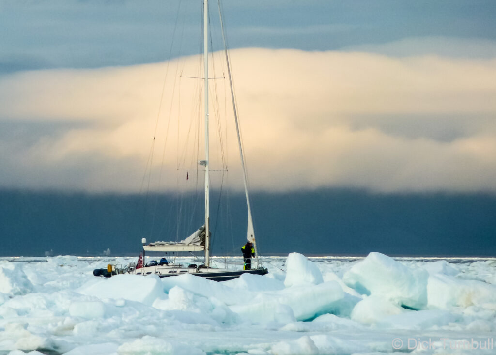
Ice can move fast. Speeds of up to 60 nautical miles per day are possible when driven by wind and current, and 30 nautical miles per day is very common. If ice is within 200 nautical miles of your position, you should monitor the situation closely.
Ice conditions vary greatly from year to year, and this variability is increasing as the Arctic warms rapidly and sea ice continues to decline.
In late July of 2011, pack ice entered Isfjorden and several visiting boats became trapped in Longyearbyen.
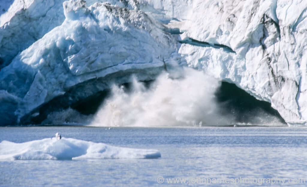
Glacier or Berg Ice
Throughout the summer, some freshwater (berg) ice calved from glaciers can be found in Spitsbergen’s fjords and anchorages, with a few larger pieces drifting along the coast.
While often strikingly beautiful, this ice requires constant vigilance when underway, especially in fog. Be aware that modern solid-state radars generally can not detect icebergs.
Ice can drift into anchorages that were previously clear, sometimes requiring a move during the night. With continuous daylight this is less problematic than it may sound, but it is still wise to maintain an ice watch while at anchor.
In some places it is possible to approach glacier fronts quite closely, but this carries real risks. Large pieces of ice can calve from the face and create powerful waves, and submerged ice may resurface some distance away.
The code for commercial vessels states safe distance as 5 x height of the glacier front but a minimum distance of 200 m.
Walking on glaciers is dangerous unless you are properly trained and equipped with crampons, an ice axe, and a rope. Guided glacier tours are available from Longyearbyen.
Berg ice is not a concern at Bjørnøya during summer.
Ice Reports
Via the Internet
The Norwegian Met Office publishes daily ice charts for Svalbard from Monday to Friday. These high-resolution charts are based on several satellite data sources, mainly Synthetic Aperture Radar (SAR) and optical imagery, and show sea ice concentration as well as areas of fast ice.
Boats with satellite communications or internet can contact Istjenesten (istjenesten@met.no) to request compressed ice chart files. Requests should include the period required and an email address. Reports are available daily, Monday to Friday.
Those with internet on board can also visit the ArcticInfo – BarentsWatch section of Kystverket’s Barentswatch website, which provides daily updated ice information and has proven to be very accurate.
Via Navtex
Ice edge information, useful for avoiding areas with ice, is broadcast in text via Navtext for Svalbard (A). Updates are transmitted daily at 0800 UTC.